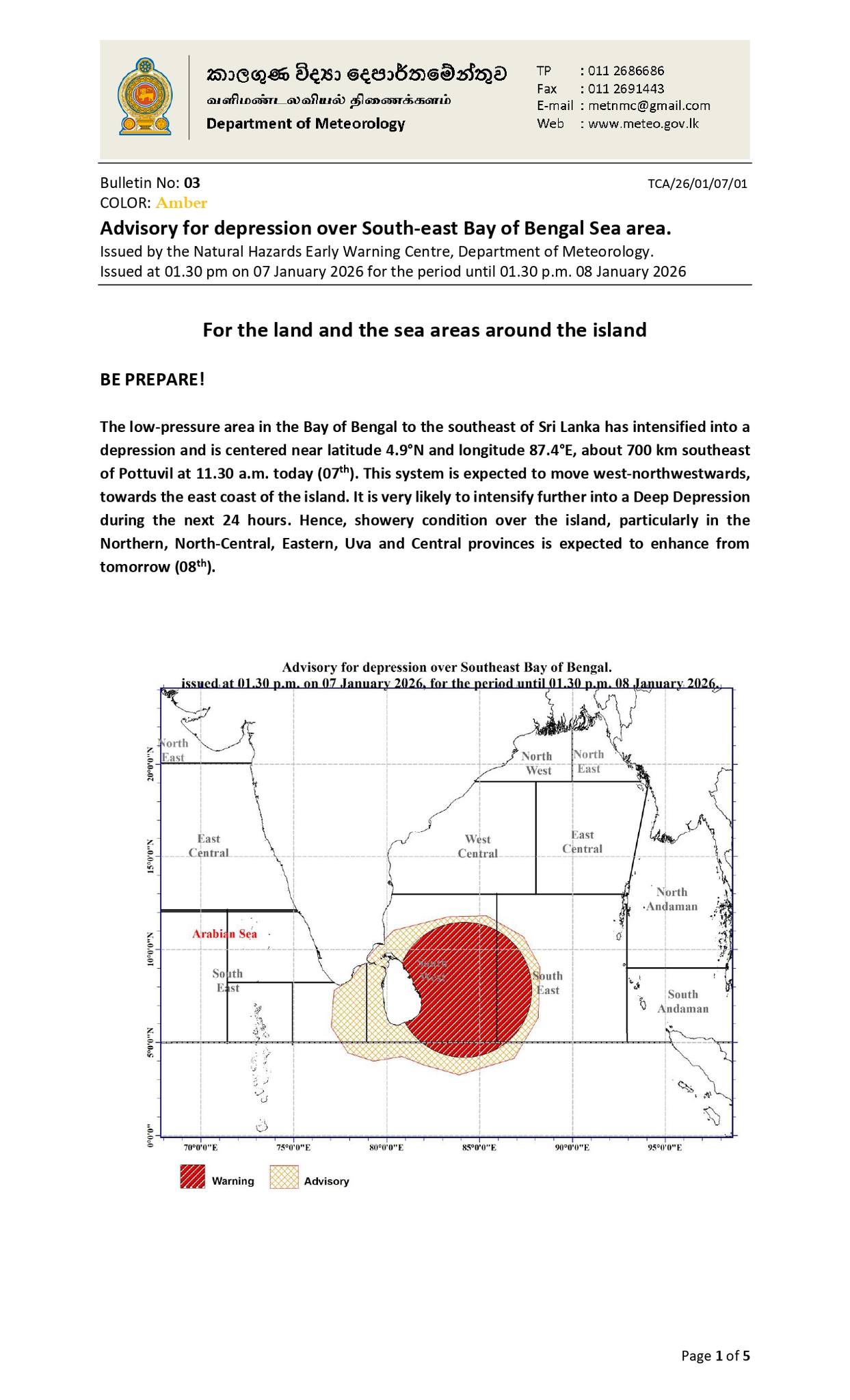

The low-pressure area in the Bay of Bengal to the southeast of Sri Lanka has intensified into a depression and is centered near latitude 4.9°N and longitude 87.4°E, about 700 km southeast of Pottuvil at 11.30 a.m. today (07th).
This system is expected to move west-northwestwards, towards the east coast of the island. It is very likely to intensify further into a Deep Depression during the next 24 hours.
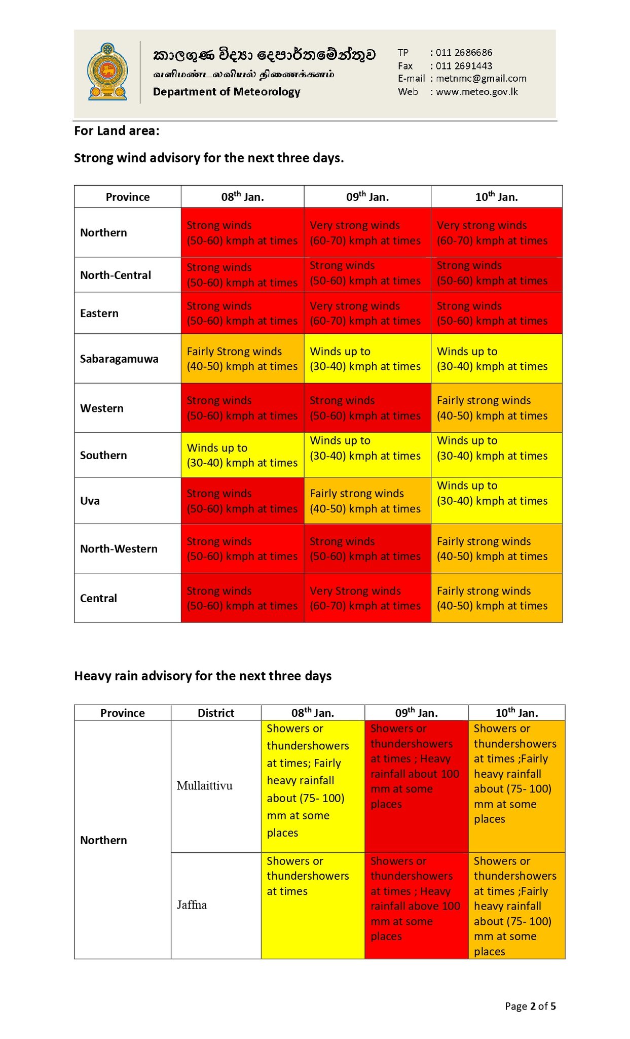
Hence, showery condition over the island, particularly in the Northern, North-Central, Eastern, Uva and Central provinces is expected to enhance from tomorrow (08th).
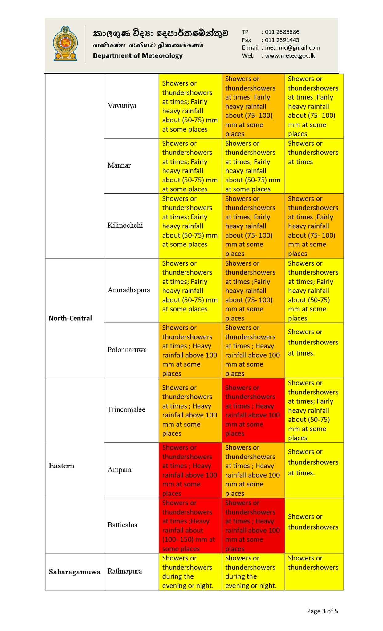
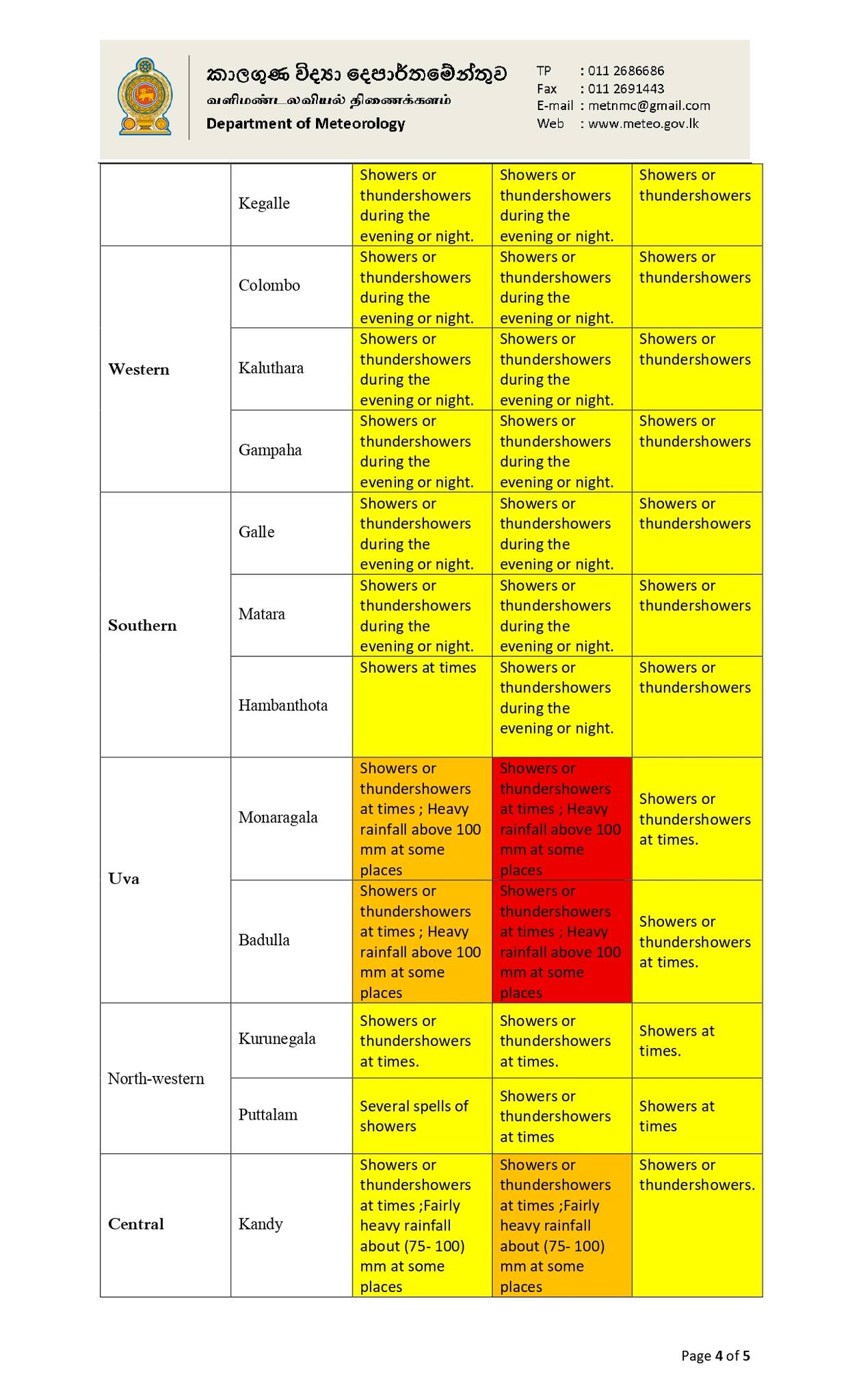
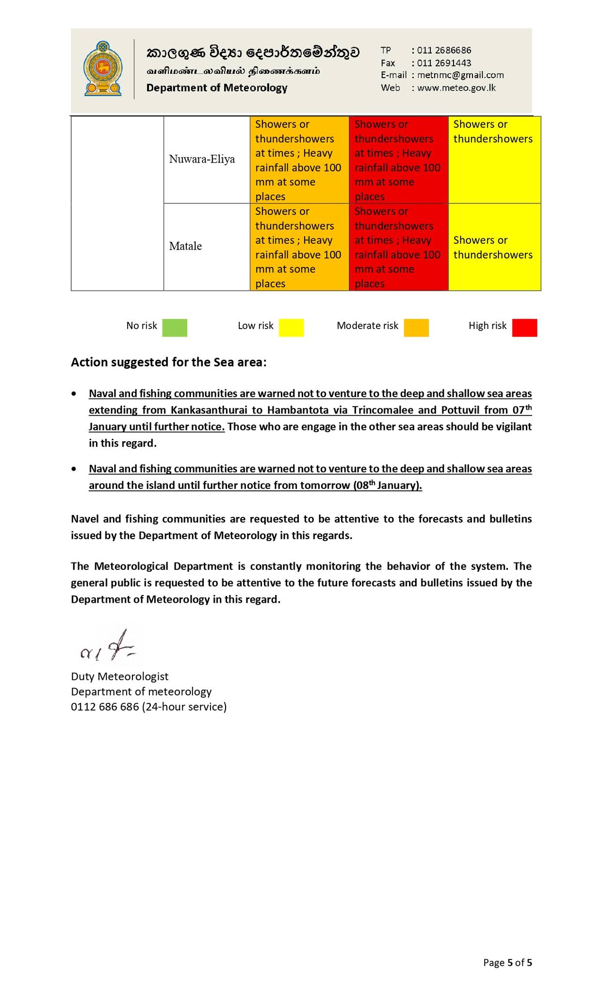
Showers or thundershowers will occur at times in Northern, North-central, Eastern, Uva and Central provinces. Heavy falls above 100 mm are likely at some places in Eastern and Uva provinces and in Polonnaruwa, Matale and Nuwara-Eliya districts.
Fairly Heavy falls above 75 mm are likely at some places in Northern provinces and in Anuradhapura and Kandy districts.
Showers or thundershowers may occur at several places elsewhere in the Island after 1.00 p.m.
Strong winds about (50-60) kmph can be expected at times over Eastern slopes of the central hills, Northern, North-central, North-western and Eastern provinces and in Hambantota, Gampaha Colombo and Monaragala districts.
The general public is kindly requested to take adequate precautions to minimize damages caused by temporary localized strong winds and lightning during thundershowers.
Advisory for depression over South-east Bay of Bengal Sea area. Issued by the Natural Hazards Early Warning Centre, Department of Meteorology.Issued at 01.30 pm on 07 January 2026 for the period until 01.30 p.m. 08 January 2026