A deserted yacht marina on Great Abaco island in the Bahamas, in preparation for Hurricane DorianThe Bahamas is bracing for Hurricane Dorian, which strengthened into a category four storm over the weekend.The "extremely dangerous" storm was expected to hit the island chain on Sunday, the US National Hurricane Center (NHC) said, before making landfall on the US east coast.Residents in Grand Bahama were preparing by boarding up businesses and evacuating the storm's predicted path.The storm surge could be as high as 15ft (4.6m), officials warned.Authorities closed some airports in the outlying islands, but the main international airport remains open on Sunday.The storm was on Sunday morning about 125 miles east of the Bahamas' Great Abaco Island, moving westward at 8mph (13km/h) with maximum sustained winds of nearly 145mph (225km/h).After hitting the Bahamas, it was expected to move up the US coast, grazing Florida, which had expected a direct hit but appeared to have been spared the worst by a change in the storm's path.
How do hurricanes form?Hurricanes, typhoons and cyclones: What's the difference?Dorian's wind speeds put the storm among the most dangerous in recent history. Forecasters warned that it could be the region's worst since the category five Hurricane Andrew killed 65 people and destroyed 63,000 homes in 1992.US President Donald Trump said he was monitoring Dorian, which he described as "an extremely dangerous storm" on Twitter. He cancelled a planned trip to Poland, sending Vice-President Mike Pence in his place.Hurricanes, which vary in strength from category one to five on the Saffir-Simpson scale, tend to get stronger as they move over warm waters like those off the coast of Florida.Forecasters said they expected Dorian to shift eastwards around the middle of the week, putting the coasts of Georgia and South Carolina at risk.As storm slows, danger increases
The NHC said "life-threatening storm surge, devastating hurricane-force winds, and heavy rains capable of life-threatening flash floods" were expected to hit the Abaco Islands and Grand Bahama on Sunday.The country's National Emergency Management Agency said it believed that the damage might be exacerbated by an expected slowing in the storm's movement, keeping it over the islands for longer.
A tropical storm watch was also in effect for a 120-mile (193km) stretch of Florida's eastern coast, with hurricane-force winds possible along the coast by early next week.Dorian's exact path remained uncertain but millions were at risk, as well as holiday attractions such as Walt Disney World and President Donald Trump's Mar-a-Lago resort.How is the Bahamas preparing?Bahamas Prime Minister Hubert Minnis announced an evacuation order for parts of Grand Bahama and the Abaco Islands, both in the north of the archipelago. All tourists were asked to leave the islands.At a news conference, Mr Minnis begged residents to head for the main island to escape the "devastating, dangerous storm"."I want you to remember: homes, houses, structures can be replaced. Lives cannot be replaced," he said, adding that 73,000 people and 21,000 homes were at risk.
In Florida, Governor Ron DeSantis declared a state of emergency for the whole state and activated 2,500 National Guard troops with another 1,500 on standby.Shoppers in Florida were seen queuing around blocks to buy supplies such as medication and fuel. The coastal city of Miami ordered the removal of electric rental scooters from the streets to avoid them becoming projectiles.
Hurricanes, typhoons and cyclones: What's the difference?Hurricane Florence is likely to cause prolonged torrential rainfall
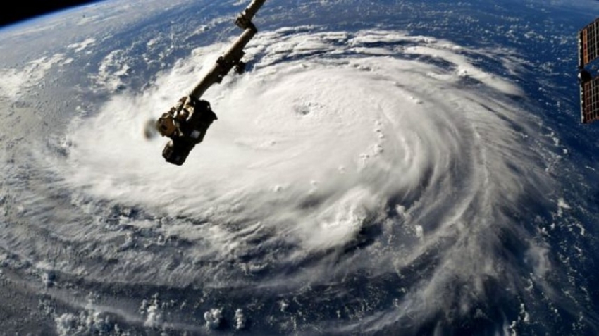
Hurricane Florence has arrived on the eastern seaboard of the United States.At the same time, Super Typhoon Mangkhut is approaching the Philippines.There are spectacular images of both shot from space, and the two weather systems look almost the same.So why do we call one a hurricane and the other a typhoon? And while we're at it - what exactly is a cyclone?All tropical storms They are all the same thing: tropical storms. But they are known by different names in different locations. In the North Atlantic Ocean and Northeast Pacific, they are called hurricanes. But if the same type of disturbance takes place in the Northwest Pacific Ocean, it is known as a typhoon.And in the South Pacific and Indian Ocean, cyclone is the correct term.
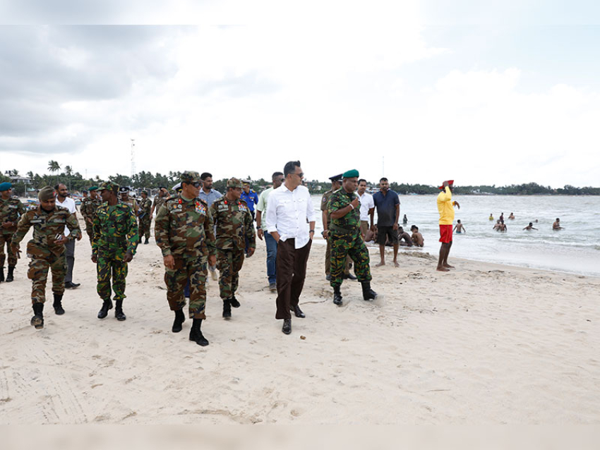
Soldiers and emergency workers have been holding drills in readiness for Typhoon Mangkhut in the Philippines
A tropical cyclone is a generic term used by meteorologists.It means a rotating, organised system of clouds and thunderstorms that originates over tropical or subtropical waters, according to the National Oceanic and Atmospheric Administration of the US."Once a tropical cyclone reaches maximum sustained winds of 74mph (119km/h) or higher, it is then classified as a hurricane, typhoon, or tropical cyclone, depending upon where the storm originates in the world."
Hurricanes are categorised between 1 to 5 based on their wind speed.When do they occur?In the Atlantic, it is hurricane season between 1 June and 30 November. More than 95% of tropical cyclone activity occurs during this period in this region.Typhoons in the Northwest Pacific Ocean are most common from May to October, although they can form year-round.And in the South Pacific, it's cyclone season between November and April.
How are they named?The World Meteorological Organization, a UN body, maintains a list to name tropical cyclones around the world.The names of the deadliest ones like Typhoon Haiyan or Hurricane Katrina are retired and replaced.Countries in the regions of hurricanes, typhoons and cyclones send suggestions for the list to the global met authority.Millions in path of Philippines typhoonPhilippines Typhoon Mangkhut: 'People are tying down their roofs'"Eight countries in our region, which covers the Bay of Bengal and the Arabian Sea, sent the list to the WMO during the early 2000s," a senior scientist with the Indian Meteorological Department told the BBC."Nearly 50% of those names for cyclones have been exhausted."The agreement between the countries in our region then was to make sure that the names do not hurt religious sentiment in our countries."
The science: How storms formAir rises quickly when it is heated by warm sea water.As the air cools down again it is pushed aside by more warm air rising below it.This cycle causes strong winds. Over the sea, a tropical storm can whip up huge waves.When these waves reach land they can flood large areas, including towns and cities.Over land the strong winds can cause a lot of damage - they can flatten homes, knock over trees and even tip over cars.
Mangkhut is forecast to strike northern part of Philippines on 14 September.
Scientists say the temperature of ocean water is going up and that can lead to hurricanes increasing in intensity in the future.They add that a hotter atmosphere can also hold more water, so this should allow hurricanes to dump more water on affected areas.There are many factors which make the relationship between climate change and hurricanes a complex one.

